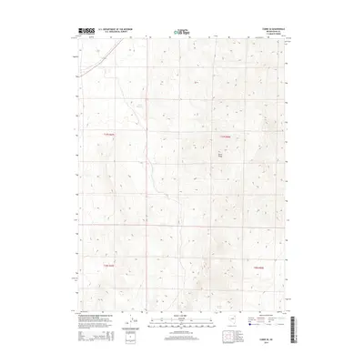
2014 Map of Cobre SE
USGS Topo · Published 2014About this map
The high-desert terrain of the Toano Range dominates this corner of northeastern Nevada, where the landscape is defined by dramatic elevation changes and sparse water sources. High-altitude drainage patterns are captured in detail, showing how seasonal runoff eventually reaches the Loray Reservoir in the northern section of the map. In a region where reliable water is the most critical resource for ranching and survival, the presence of Granite Springs near the southern boundary highlights a vital natural landmark in the Elko County backcountry. This survey illustrates the township and range grid system overlaid on the basin and range geography, providing a precise record of the land divisions across T37N R67E and adjacent sections during the early 21st century.
Find a feature on this map
7 named features on this map. Tap any name to fly to it.
Don’t see what you’re looking for? This feature index may not catch every label — zoom into the map to look around manually.
Map Details
Editions of this 2014 Cobre SE Map
This is the sole edition of this map. No revisions or reprints were ever made.
Other maps of this area

1955 · Wells
USGS Topo · 1:250,000

1955 · Elko
USGS Topo · 1:250,000

1958 · Wells
USGS Topo · 1:250,000

1958 · Elko
USGS Topo · 1:250,000

1961 · Wells
USGS Topo · 1:250,000

1962 · Elko
USGS Topo · 1:250,000

1965 · Elko
USGS Topo · 1:250,000

1967 · Valley Pass
USGS Topo · 1:24,000

1967 · Loray
USGS Topo · 1:24,000
1967 · Pilot Peak NW
USGS Topo · 1:24,000