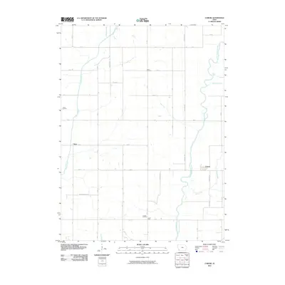
2010 Map of Coburg
USGS Topo · Published 2010About this map
The East Nishnabotna River snakes through the eastern portion of this Montgomery County landscape, defining the local geography alongside several significant tributaries like Mormon Branch and Ramp Creek. Small rural settlements such as Coburg and Climax serve as the primary hubs for this agricultural area, which is organized by a rigid grid of roads including Evergreen Ave and Boxelder Ave.
Find a feature on this map
33 named features on this map. Tap any name to fly to it.
Don’t see what you’re looking for? This feature index may not catch every label — zoom into the map to look around manually.
Map Details
Editions of this 2010 Coburg Map
This is the sole edition of this map. No revisions or reprints were ever made.
Other maps of this area

1954 · Omaha
USGS Topo · 1:250,000

1955 · Nebraska City
USGS Topo · 1:250,000

1957 · Nebraska City
USGS Topo · 1:250,000

1957 · Omaha
USGS Topo · 1:250,000

1958 · Omaha
USGS Topo · 1:250,000

1958 · Nebraska City
USGS Topo · 1:250,000

1978 · Shenandoah East
USGS Topo · 1:24,000
1978 · Emerson
USGS Topo · 1:24,000

1978 · Stanton SW
USGS Topo · 1:24,000

1978 · Wales
USGS Topo · 1:24,000