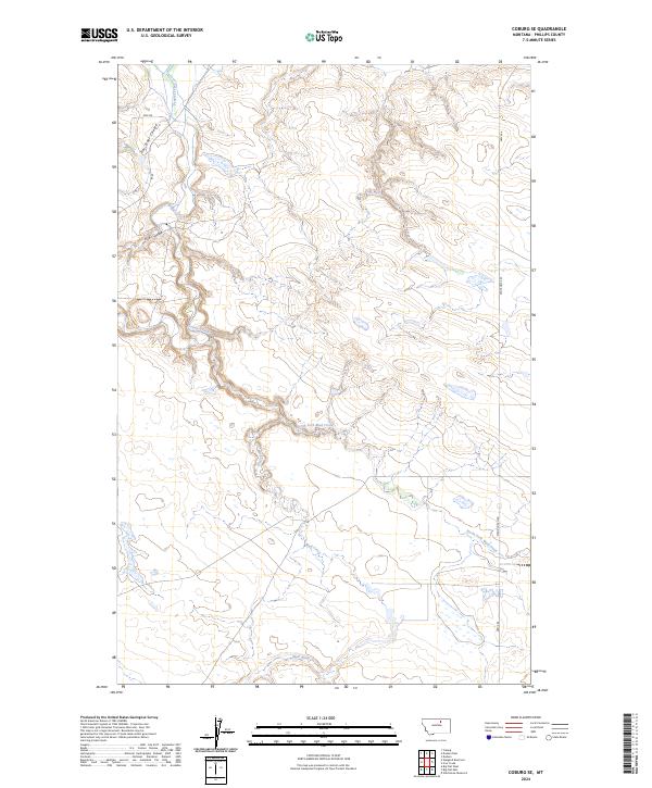
2024 Map of Coburg SE
USGS Topo · Published 2024About this map
Peoples Creek meanders through this portion of Phillips County, carving a distinct path through the drainage systems that define the local landscape. The map illustrates a network of coulees and creek beds, including the prominent Box Elder Coulee and Kuhr Coulee, which channel seasonal runoff into the larger waterways. These geographical features dictate the placement of transportation routes like Stage Coach Rd and Hwy 204, which navigate the elevation changes between the creek valleys and the surrounding plains. The drainage patterns of North Fork Mud Creek and Mud Creek further emphasize the hydrological character of the region, providing a detailed look at the land's natural contours and the rural infrastructure that serves it.
Find a feature on this map
14 named features on this map. Tap any name to fly to it.
Don’t see what you’re looking for? This feature index may not catch every label — zoom into the map to look around manually.
Map Details
Editions of this 2024 Coburg SE Map
This is the sole edition of this map. No revisions or reprints were ever made.
Other maps of this area

1953 · Havre
USGS Topo · 1:250,000

1957 · Havre
USGS Topo · 1:250,000

1958 · Havre
USGS Topo · 1:250,000

1964 · Coburg
USGS Topo · 1:24,000

1964 · Coburg SE
USGS Topo · 1:24,000

1964 · Weigand Reservoir
USGS Topo · 1:24,000

1964 · Dodson
USGS Topo · 1:24,000

1964 · Cow Creek
USGS Topo · 1:24,000

1964 · Dodson Dam
USGS Topo · 1:24,000

1965 · Wild Horse Reservoir
USGS Topo · 1:24,000