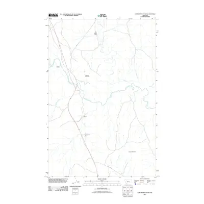
2011 Map of Coburn Mountain
USGS Topo · Published 2011About this map
The Dearborn River winds through this central Montana landscape, creating a drainage network that includes Flat Creek, Deadman Creek, and Sullivan Creek. The area is characterized by significant topographical landmarks such as Elephant Mountain and Coburn Mountain, which rise above the surrounding terrain. For local historians and genealogists, the map preserves the location of the Dearborn Cemetery and the Dearborn Ranch, offering a glimpse into the rural settlement patterns of the region.
Find a feature on this map
15 named features on this map. Tap any name to fly to it.
Don’t see what you’re looking for? This feature index may not catch every label — zoom into the map to look around manually.
Map Details
Editions of this 2011 Coburn Mountain Map
This is the sole edition of this map. No revisions or reprints were ever made.
Other maps of this area

1886 · Great Falls
USGS Topo · 1:250,000

1943 · Hogan
USGS Topo · 1:125,000

1954 · Great Falls
USGS Topo · 1:250,000

1955 · Choteau
USGS Topo · 1:250,000

1957 · Choteau
USGS Topo · 1:250,000

1957 · Great Falls
USGS Topo · 1:250,000

1958 · Choteau
USGS Topo · 1:250,000

1960 · Simms
USGS Topo · 1:62,500

1961 · Craig
USGS Topo · 1:24,000
1961 · Roberts Mountain
USGS Topo · 1:24,000