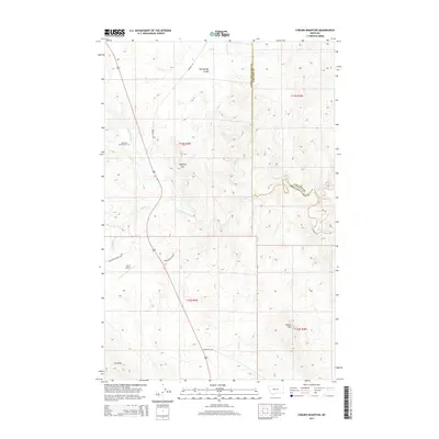
2014 Map of Coburn Mountain
USGS Topo · Published 2014About this map
The Dearborn River snakes through this high-plains landscape on the border of Lewis and Clark and Cascade counties. The area is characterized by dramatic elevation changes, from the prominent heights of Coburn Mtn and Elephant Mtn to the deeply carved drainage of Dead Man Coulee. Human presence is marked by ranching infrastructure and remote air transit at the Bar E Airport, while the Dearborn Crossing Cem serves as a silent witness to the early settlers who navigated this river crossing. Long-established routes like Birdtail Rd and Sevenmile Rd follow the natural contours of the land, connecting isolated ranching operations. The presence of the Hultine Ditch and the Sullivan Cr suggests a landscape defined by the management of water in an arid environment, where even seasonal flows dictate the placement of roads and homesteads.
Find a feature on this map
23 named features on this map. Tap any name to fly to it.
Don’t see what you’re looking for? This feature index may not catch every label — zoom into the map to look around manually.
Map Details
Editions of this 2014 Coburn Mountain Map
This is the sole edition of this map. No revisions or reprints were ever made.
Other maps of this area

1886 · Great Falls
USGS Topo · 1:250,000

1943 · Hogan
USGS Topo · 1:125,000

1954 · Great Falls
USGS Topo · 1:250,000

1955 · Choteau
USGS Topo · 1:250,000

1957 · Choteau
USGS Topo · 1:250,000

1957 · Great Falls
USGS Topo · 1:250,000

1958 · Choteau
USGS Topo · 1:250,000

1960 · Simms
USGS Topo · 1:62,500

1961 · Craig
USGS Topo · 1:24,000
1961 · Roberts Mountain
USGS Topo · 1:24,000