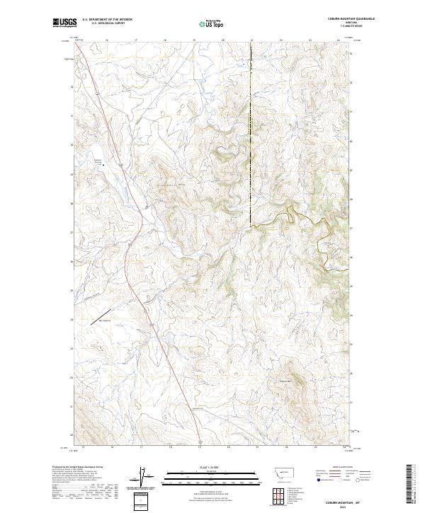
2024 Map of Coburn Mountain
USGS Topo · Published 2024About this map
The Dearborn River carves a winding path through this portion of the Montana landscape, marking the transition between the plains and the rising foothills. Centered on the boundary of Lewis and Clark and Cascade counties, the map documents a terrain defined by significant peaks such as Elephant Mtn and Coburn Mtn. The presence of the Dearborn Crossing Cem suggests the historical importance of the river as a focal point for early transit and local community life in this high-country setting.
Find a feature on this map
20 named features on this map. Tap any name to fly to it.
Don’t see what you’re looking for? This feature index may not catch every label — zoom into the map to look around manually.
Map Details
Editions of this 2024 Coburn Mountain Map
This is the sole edition of this map. No revisions or reprints were ever made.
Other maps of this area

1886 · Great Falls
USGS Topo · 1:250,000

1943 · Hogan
USGS Topo · 1:125,000

1954 · Great Falls
USGS Topo · 1:250,000

1955 · Choteau
USGS Topo · 1:250,000

1957 · Choteau
USGS Topo · 1:250,000

1957 · Great Falls
USGS Topo · 1:250,000

1958 · Choteau
USGS Topo · 1:250,000

1960 · Simms
USGS Topo · 1:62,500

1961 · Craig
USGS Topo · 1:24,000
1961 · Roberts Mountain
USGS Topo · 1:24,000