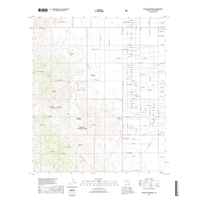
2018 Map of Cochise Stronghold
USGS Topo · Published 2018About this map
Arizona Sun Sites is situated on the eastern edge of the Dragoon Mountains, where the grid of a mid-century desert development meets the dramatic peaks and canyons of the Coronado National Forest. This landscape is defined by its transition from the valley floor to high-elevation formations like Rockfellow Dome and Cochise Peak. To the west, the rugged terrain of Stronghold Canyon West and Stronghold Canyon East highlights the area's natural defenses, which historically centered around the Cochise Stronghold. Water sources, while sparse, are strategically located in the heights, including Carlink Spring, Barret Spring, and Halfmoon Tank. In the south, the terrain climbs toward China Peak and Jones Mtn, overlooking the winding path of Middlemarch Canyon. The map reveals the contrast between the rigid residential planning of the Sun Sites and the complex topography of the canyon system to its west.
Find a feature on this map
119 named features on this map. Tap any name to fly to it.
Don’t see what you’re looking for? This feature index may not catch every label — zoom into the map to look around manually.
Map Details
Editions of this 2018 Cochise Stronghold Map
This is the sole edition of this map. No revisions or reprints were ever made.
Other maps of this area

1915 · Benson
USGS Topo · 1:125,000

1916 · Pearce
USGS Topo · 1:125,000

1922 · Willcox
USGS Topo · 1:125,000

1922 · St. David
USGS Topo · 1:62,500

1926 · Courtland
USGS Topo · 1:62,500

1943 · Benson
USGS Topo · 1:125,000

1943 · Cochise
USGS Topo · 1:62,500

1943 · Dragoon
USGS Topo · 1:62,500

1954 · Silver City
USGS Topo · 1:250,000

1955 · Douglas
USGS Topo · 1:250,000