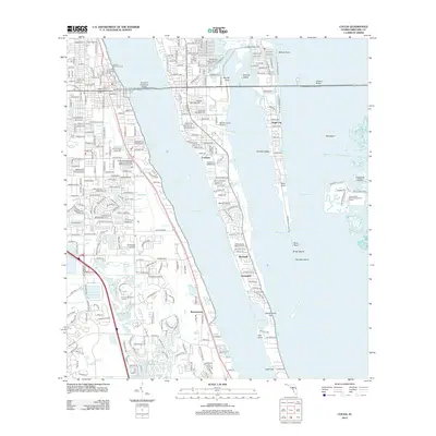
2012 Map of Cocoa
USGS Topo · Published 2012About this map
Merritt Island sits at the heart of this coastal survey, where the Indian River and Banana River converge in a network of lagoons and islands. The area shows a sophisticated infrastructure of water management and aviation, including the Merritt Island Airport and the Rockledge Airpark. Settlements like Georgiana, Angel City, and Rockwell dot the coastline, connected by the prominent Hubert H Humphrey Bridge. Along the western shore, the Cocoa Yacht Basin and Indian River Yacht Club Marina underscore the region's long-standing relationship with the water. The landscape is also defined by significant memorial sites, notably the Florida Memorial Cem and Brevard Memorial Park. Further east, the intricate cluster of the Thousand Islands illustrates the complex estuarine environment before the waters reach landmarks like Cape Cod and Honeymoon Hill.
Find a feature on this map
41 named features on this map. Tap any name to fly to it.
Don’t see what you’re looking for? This feature index may not catch every label — zoom into the map to look around manually.
Map Details
Editions of this 2012 Cocoa Map
This is the sole edition of this map. No revisions or reprints were ever made.
Other maps of this area

1949 · Courtenay
USGS Topo · 1:24,000

1949 · Eau Gallie
USGS Topo · 1:24,000

1949 · Sharpes
USGS Topo · 1:24,000

1949 · Cocoa
USGS Topo · 1:24,000

1949 · Cocoa Beach
USGS Topo · 1:24,000

1949 · Tropic
USGS Topo · 1:24,000

1951 · Eau Gallie
USGS Topo · 1:24,000

1951 · Cocoa
USGS Topo · 1:24,000

1951 · Courtenay
USGS Topo · 1:24,000

1951 · Sharpes
USGS Topo · 1:24,000