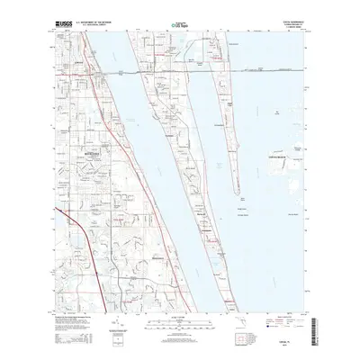
2015 Map of Cocoa
USGS Topo · Published 2015About this map
Merritt Island sits at the heart of this coastal geography, bounded by the Indian River and the Banana River. This modern survey documents the dense corridor between Cocoa and Cocoa Beach, linked by the Hubert H Humphrey Bridge and the extensive Merritt Island Cswy E. While the mainland is dominated by the urban grid of Rockledge, the island portion reveals a series of historic small settlements such as Georgiana, Angel City, and Rockwell along the eastern shore of the Indian River Lagoon.
Find a feature on this map
45 named features on this map. Tap any name to fly to it.
Don’t see what you’re looking for? This feature index may not catch every label — zoom into the map to look around manually.
Map Details
Editions of this 2015 Cocoa Map
This is the sole edition of this map. No revisions or reprints were ever made.
Other maps of this area

1949 · Courtenay
USGS Topo · 1:24,000

1949 · Eau Gallie
USGS Topo · 1:24,000

1949 · Sharpes
USGS Topo · 1:24,000

1949 · Cocoa
USGS Topo · 1:24,000

1949 · Cocoa Beach
USGS Topo · 1:24,000

1949 · Tropic
USGS Topo · 1:24,000

1951 · Eau Gallie
USGS Topo · 1:24,000

1951 · Cocoa
USGS Topo · 1:24,000

1951 · Courtenay
USGS Topo · 1:24,000

1951 · Sharpes
USGS Topo · 1:24,000