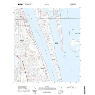
2021 Map of Cocoa
USGS Topo · Published 2021About this map
The Indian River and Banana River dominate this coastal Florida landscape, framing the expansive landmass of Merritt Island. On the mainland, the established communities of Cocoa and Rockledge showcase dense residential patterns and the historic City Cem, while the newer developments of Viera East represent modern growth to the south. The area's dependence on water and air transport is evident through the Intracoastal Waterway, the Hubert H Humphrey Bridge, and local hubs like Merritt Island Airport and Rockledge Airport. Along the lagoons, smaller named settlements such as Georgiana, Rockwell, and Angel City line the shores, providing a detailed look at the island's mid-century settlement patterns and coastal landmarks like Honeymoon Hill and Pullman Point.
Find a feature on this map
45 named features on this map. Tap any name to fly to it.
Don’t see what you’re looking for? This feature index may not catch every label — zoom into the map to look around manually.
Map Details
Editions of this 2021 Cocoa Map
This is the sole edition of this map. No revisions or reprints were ever made.
Other maps of this area

1949 · Courtenay
USGS Topo · 1:24,000

1949 · Eau Gallie
USGS Topo · 1:24,000

1949 · Sharpes
USGS Topo · 1:24,000

1949 · Cocoa
USGS Topo · 1:24,000

1949 · Cocoa Beach
USGS Topo · 1:24,000

1949 · Tropic
USGS Topo · 1:24,000

1951 · Eau Gallie
USGS Topo · 1:24,000

1951 · Cocoa
USGS Topo · 1:24,000

1951 · Courtenay
USGS Topo · 1:24,000

1951 · Sharpes
USGS Topo · 1:24,000