2024 Map of Cocoa
USGS Topo · Published 2024About this map
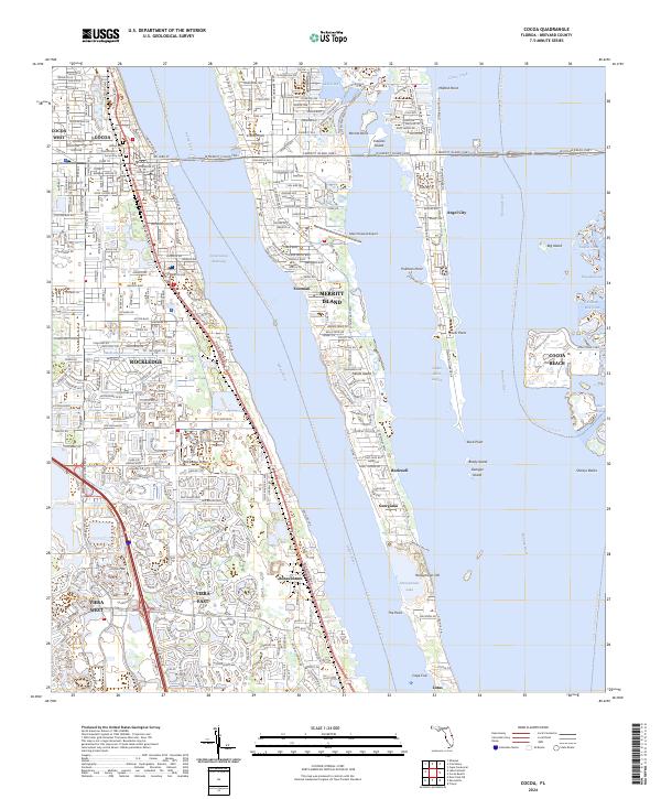
Merritt Island dominates the central portion of this coastal landscape, situated between the Indian River and the Banana River. This modern survey illustrates the dense residential expansion around Cocoa and Rockledge, while smaller communities like Georgiana, Angel City, and Bonaventure retain their distinct identities along the waterways. The presence of both the Merritt Island Airport and Rockledge Airport underscores the region's aviation activity, while the Intracoastal Waterway serves as a primary navigation corridor.
Find a feature on this map
50 named features on this map. Tap any name to fly to it.
Don’t see what you’re looking for? This feature index may not catch every label — zoom into the map to look around manually.
Map Details
Editions of this 2024 Cocoa Map
This is the sole edition of this map. No revisions or reprints were ever made.
Historical Maps of Footman Through Time
4 maps found