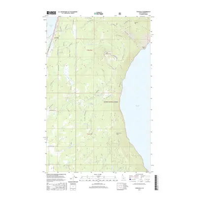
2017 Map of Cocolalla
USGS Topo · Published 2017About this map
Cocolalla sits at the northern edge of this Idaho landscape, nestled between the waters of Cocolalla Lake and the steep slopes of Blacktail Mtn. The terrain is defined by the sharp transition from the valley floor to the high ridges of the Kaniksu National Forest, where features like Three Sisters Peaks and Little Blacktail Mtn overlook the western shoreline of Lake Pend Oreille. This 2017 survey shows a network of forest roads and secondary routes such as South Side School Rd and Old Hwy 95, which trace the historical movement patterns of the area. Local heritage is grounded in landmarks like the Drake Cem and named points along the water including Maiden Rock. A dense drainage system, including Cocolalla Cr and Maiden Creek, illustrates how the mountain snowmelt feeds the region's prominent lakes.
Find a feature on this map
60 named features on this map. Tap any name to fly to it.
Don’t see what you’re looking for? This feature index may not catch every label — zoom into the map to look around manually.
Map Details
Editions of this 2017 Cocolalla Map
This is the sole edition of this map. No revisions or reprints were ever made.
Other maps of this area

1901 · Sandpoint
USGS Topo · 1:125,000

1903 · Rathdrum
USGS Topo · 1:125,000

1909 · Cataldo
USGS Topo · 1:125,000

1911 · Cataldo
USGS Topo · 1:125,000

1911 · Priest Lake
USGS Topo · 1:250,000

1911 · Sandpoint
USGS Topo · 1:125,000

1913 · Priest Lake
USGS Topo · 1:250,000

1949 · Packsaddle Mtn
USGS Topo · 1:62,500

1951 · Packsaddle Mtn
USGS Topo · 1:62,500

1955 · Spokane
USGS Topo · 1:250,000