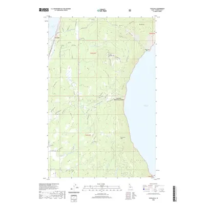
2020 Map of Cocolalla
USGS Topo · Published 2020About this map
The mountain community of Cocolalla sits at the edge of Cocolalla Lake, a landscape defined by the towering heights of the Kaniksu National Forest and the deep waters of Lake Pend Oreille. This 2020 survey reveals a complex network of forest development roads and mountain trails, such as the Talache-Blacktail and Cocolalla E Ohv, which provide access to high-elevation landmarks like Blacktail Mtn and the Three Sisters Peaks. The map reflects a region where residential developments like Mount Smith Ests meet the timbered slopes of Little Blacktail Mtn. Local history is anchored by sites such as the Drake Cem and Maiden Rock along the lakeshore. The presence of Old Hwy 95 and Butler Creek Rd illustrates the evolution of travel through this corridor of Bonner County, tracing the routes that connect narrow valleys to the expansive shoreline at Evans Landing.
Find a feature on this map
71 named features on this map. Tap any name to fly to it.
Don’t see what you’re looking for? This feature index may not catch every label — zoom into the map to look around manually.
Map Details
Editions of this 2020 Cocolalla Map
This is the sole edition of this map. No revisions or reprints were ever made.
Other maps of this area

1901 · Sandpoint
USGS Topo · 1:125,000

1903 · Rathdrum
USGS Topo · 1:125,000

1909 · Cataldo
USGS Topo · 1:125,000

1911 · Cataldo
USGS Topo · 1:125,000

1911 · Priest Lake
USGS Topo · 1:250,000

1911 · Sandpoint
USGS Topo · 1:125,000

1913 · Priest Lake
USGS Topo · 1:250,000

1949 · Packsaddle Mtn
USGS Topo · 1:62,500

1951 · Packsaddle Mtn
USGS Topo · 1:62,500

1955 · Spokane
USGS Topo · 1:250,000