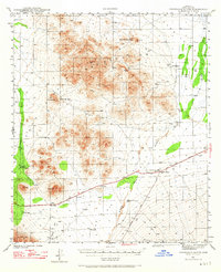
1941 Map of Cocoraque Butte
USGS Topo · Published 1965About this map
The Tohono O'odham nation and surrounding Pima County desert are documented here just before the mid-century, following a 1940-1941 survey by P. C. Erickson and J. G. Collins. The landscape is defined by traditional settlements like Viopuli and Nawt Vaya situated near the western edge of the Reservation. Transportation and commerce converge at Robles Junction, where the Ajo Tucson Highway meets the Sasabe Road. This intersection serves as a vital link between the outlying cattle operations, including Cocoraque Ranch, La Tortuga Ranch, and Dill Ranch. The topography is dominated by the volcanic forms of the Roskruge Mountains and the Coyote Mountains, with the prominent Cocoraque Butte rising near the northern boundary. Natural drainage patterns are dictated by the expansive Brawly Wash and Aguirre Pass, which channel seasonal water through this arid basin.
Find a feature on this map
23 named features on this map. Tap any name to fly to it.
Don’t see what you’re looking for? This feature index may not catch every label — zoom into the map to look around manually.
Map Details
Editions of this 1941 Cocoraque Butte Map
2 editions found

Other maps of this area

1920 · Arivaca
USGS Topo · 1:125,000

1925 · Samaniego Peak
USGS Topo · 1:62,500

1925 · San Xavier
USGS Topo · 1:62,500

1934 · Tucson Mountains
USGS Topo · 1:125,000

1934 · Silver Bell
USGS Topo · 1:125,000

1938 · San Vicente
USGS Topo · 1:62,500

1939 · Twin Buttes
USGS Topo · 1:62,500

1940 · Palo Alto Ranch
USGS Topo · 1:62,500

1941 · Twin Buttes
USGS Topo · 1:62,500

1941 · San Vicente
USGS Topo · 1:62,500
Featured Places
- Three Points, AZ
- Hayhook Ranch, AZ
- San Pedro, Schuk Toak District
- Robles Junction, AZ
- Schuk Toak District, AZ