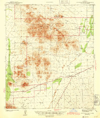
1943 Map of Cocoraque Butte
USGS Topo · Published 1943About this map
The Papago Indian Reservation dominates this desert landscape in Pima County, surveyed just before the United States entered the second World War. Settlement patterns are defined by a network of isolated ranches and water features, illustrating the challenges of life in the Altar Valley region. Notable outposts like Cocoraque Ranch, Garcia Ranch, and La Tortuga Ranch are scattered among prominent terrain features such as Cocoraque Butte and Pescadero Mtn. In the southeastern corner, the crossroads of Three Points and Robles Junction serve as a hub for local travelers, situated where the Tucson Ajo Highway meets the Sasabe Road. This junction includes the Three Points Sch, a vital community marker in an area otherwise characterized by ephemeral drainage systems like Brawly Wash and the northern reaches of the Coyote Mountains.
Find a feature on this map
25 named features on this map. Tap any name to fly to it.
Don’t see what you’re looking for? This feature index may not catch every label — zoom into the map to look around manually.
Map Details
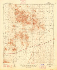
Editions of this 1943 Cocoraque Butte Map
3 editions found

Other maps of this area

1920 · Arivaca
USGS Topo · 1:125,000

1925 · Samaniego Peak
USGS Topo · 1:62,500

1925 · San Xavier
USGS Topo · 1:62,500

1934 · Tucson Mountains
USGS Topo · 1:125,000

1934 · Silver Bell
USGS Topo · 1:125,000

1938 · San Vicente
USGS Topo · 1:62,500

1939 · Twin Buttes
USGS Topo · 1:62,500

1940 · Palo Alto Ranch
USGS Topo · 1:62,500

1941 · Twin Buttes
USGS Topo · 1:62,500

1941 · San Vicente
USGS Topo · 1:62,500
Featured Places
- Three Points, AZ
- Hayhook Ranch, AZ
- San Pedro, Schuk Toak District
- Robles Junction, AZ
- Schuk Toak District, AZ