
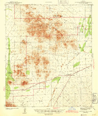
1943 Map of Cocoraque Butte
USGS Topo · Published 1943About this map
The Papago Indian Reservation occupies a significant portion of this high-desert landscape in the early 1940s, characterized by isolated peaks and seasonal watercourses. Settlements like Viopuli and Nawt Vaya are situated near the western boundary, while the eastern flats are dominated by the Brawly Wash drainage system. The intersection of the Tucson Ajo Highway and Sasabe Road creates a local hub at Robles Junction, where the Three Points Sch served the surrounding ranching community. Numerous family-named homesteads such as Cocoraque Ranch, Garcia Ranch, and La Tortuga Ranch are scattered throughout the territory, demonstrating the reliance on wells and tanks in this arid environment. The map provides a clear look at the network of "routes usually traveled" that connected these remote desert outposts before the expansion of modern infrastructure.
Find a feature on this map
23 named features on this map. Tap any name to fly to it.
Don’t see what you’re looking for? This feature index may not catch every label — zoom into the map to look around manually.
Map Details
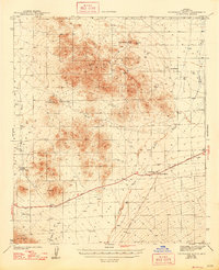
Editions of this 1943 Cocoraque Butte Map
3 editions found
Other maps of this area

1920 · Arivaca
USGS Topo · 1:125,000

1925 · Samaniego Peak
USGS Topo · 1:62,500

1925 · San Xavier
USGS Topo · 1:62,500

1934 · Tucson Mountains
USGS Topo · 1:125,000

1934 · Silver Bell
USGS Topo · 1:125,000

1938 · San Vicente
USGS Topo · 1:62,500

1939 · Twin Buttes
USGS Topo · 1:62,500

1940 · Palo Alto Ranch
USGS Topo · 1:62,500

1941 · Twin Buttes
USGS Topo · 1:62,500

1941 · San Vicente
USGS Topo · 1:62,500
Featured Places
- Three Points, AZ
- Hayhook Ranch, AZ
- San Pedro, Schuk Toak District
- Robles Junction, AZ
- Schuk Toak District, AZ