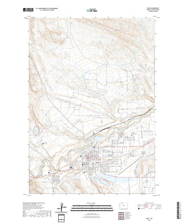
2021 Map of Cody
USGS Topo · Published 2021About this map
The Shoshone River carves a path through this landscape, anchoring the city of Cody and its surrounding agricultural infrastructure. This 2021 survey details an intricate network of irrigation, including the Heart Mountain Canal, Watkins Lateral Ditch, and Cody Canal, reflecting the region's long-standing reliance on water management for mountain-basin settlement. Cultural sites are particularly prominent, from the historic Old Trail Town Cem and Riverside Cem to the modern presence of Northwest College Cody Center and the Park County Courthouse.
Find a feature on this map
94 named features on this map. Tap any name to fly to it.
Don’t see what you’re looking for? This feature index may not catch every label — zoom into the map to look around manually.
Map Details
Editions of this 2021 Cody Map
This is the sole edition of this map. No revisions or reprints were ever made.
Other maps of this area

1911 · Oregon Basin
USGS Topo · 1:62,500

1913 · Oregon Basin
USGS Topo · 1:62,500

1949 · Cody
USGS Topo · 1:62,500

1951 · Cody
USGS Topo · 1:62,500

1955 · Cody
USGS Topo · 1:250,000

1957 · Devils Tooth
USGS Topo · 1:62,500

1958 · Cody
USGS Topo · 1:250,000

1962 · Cody
USGS Topo · 1:250,000

1966 · Corbett Dam
USGS Topo · 1:24,000
1966 · Vocation
USGS Topo · 1:24,000