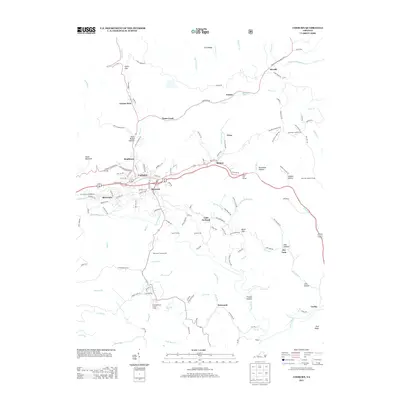
2013 Map of Coeburn
USGS Topo · Published 2013About this map
Coeburn and the surrounding coal-country communities occupy a complex landscape of narrow valleys and ridges in southwestern Virginia. The convergence of Bondtown, Maytown, and Riverview near the center of the sheet reflects a dense pattern of settlement along the waterways of Little Toms Cr and the Guest River. Transport through the area is marked by significant engineering, including the Little Tom Tunnel and Swede Tunnel, illustrating how the rail and road network navigated the winding gaps of the Appalachians.
Find a feature on this map
143 named features on this map. Tap any name to fly to it.
Don’t see what you’re looking for? This feature index may not catch every label — zoom into the map to look around manually.
Map Details
Editions of this 2013 Coeburn Map
This is the sole edition of this map. No revisions or reprints were ever made.
Other maps of this area

1886 · Grundy
USGS Topo · 1:125,000

1890 · Whitesburg
USGS Topo · 1:125,000

1890 · Grundy
USGS Topo · 1:125,000

1892 · Grundy
USGS Topo · 1:125,000

1892 · Whitesburg
USGS Topo · 1:125,000

1894 · Estillville
USGS Topo · 1:125,000

1897 · Bristol
USGS Topo · 1:125,000

1902 · Bristol
USGS Topo · 1:125,000

1912 · Pound
USGS Topo · 1:48,000

1913 · Clintwood
USGS Topo · 1:62,500