2022 Map of Coeburn
USGS Topo · Published 2022About this map
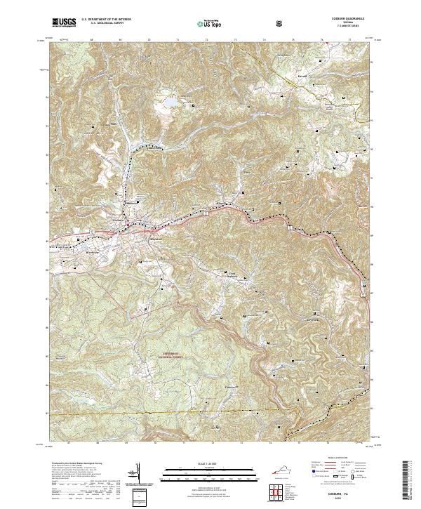
Coeburn and its neighboring coal-country settlements sit at the heart of this terrain, where the Norfolk Southern railroad follows the winding path of Toms Creek. The landscape is defined by the sharp ridges of Guest Mtn and Caney Ridge, with the Tennessee Valley Divide cutting across the highlands. This recent survey captures the modern road network, including the Dr Ralph Stanley Hwy, alongside the extensive Jefferson National Forest. For genealogists, the map is remarkably dense with family-named burial sites like the Greenwood Memorial Gardens Cem, Stallard Cem, and Kilgore Cem. The geography also highlights the transition to outdoor recreation, featuring the Heart Of Appalachia Bike Route Trl and the Guest River Gorge Trl. These corridors connect older locales like Maytown, Bondtown, and Banner through a complex network of hollows and gaps, illustrating the enduring settlement patterns of Wise County.
Find a feature on this map
155 named features on this map. Tap any name to fly to it.
Don’t see what you’re looking for? This feature index may not catch every label — zoom into the map to look around manually.
Map Details
Editions of this 2022 Coeburn Map
This is the sole edition of this map. No revisions or reprints were ever made.