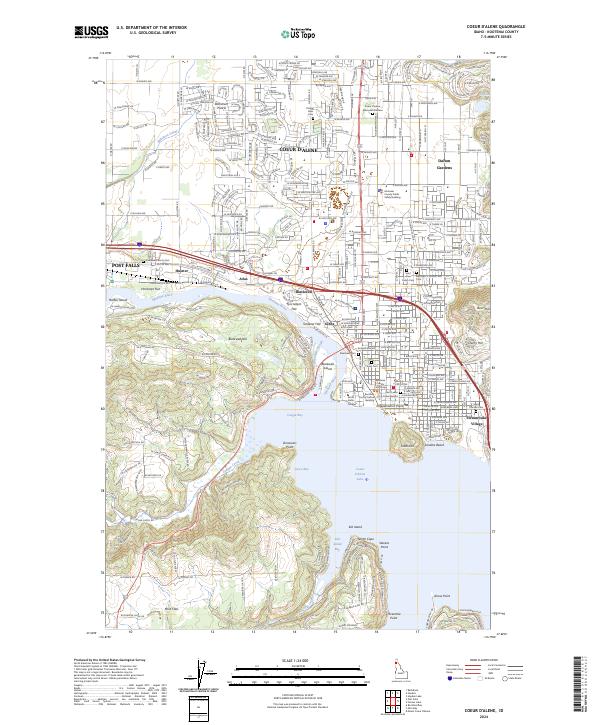
2024 Map of Coeur D'Alene
USGS Topo · Published 2024About this map
Coeur d'Alene sits at the headwaters of the Spokane River in this detailed modern record of Kootenai County's urban and natural landscape. The map illustrates a high density of civic and religious institutions, including the Kootenai County Courthouse, North Idaho College, and several historical burial grounds such as Forest Cem and Saint Thomas Cem. The transition from the developed grid of the city to the waters of Coeur d'Alene Lake is marked by distinctive geographical features like Tubbs Hill and Sanders Beach. To the west, the industrial and residential corridors of Post Falls and Huetter follow the river, while the broad Rathdrum Prairie extends to the north. This survey documents the complex interface between the growing city and its natural topography, from the shoreline of Cougar Bay to the rising elevations of Best Hill and Blackwell Hill.
Find a feature on this map
74 named features on this map. Tap any name to fly to it.
Don’t see what you’re looking for? This feature index may not catch every label — zoom into the map to look around manually.
Map Details
Editions of this 2024 Coeur D'Alene Map
This is the sole edition of this map. No revisions or reprints were ever made.
Other maps of this area

1903 · Rathdrum
USGS Topo · 1:125,000

1955 · Spokane
USGS Topo · 1:250,000

1957 · Coeur D'Alene
USGS Topo · 1:62,500

1957 · Lane
USGS Topo · 1:62,500

1958 · Spokane
USGS Topo · 1:250,000

1961 · Hayden
USGS Topo · 1:24,000

1961 · Rathdrum
USGS Topo · 1:24,000

1961 · Spirit Lake
USGS Topo · 1:62,500

1961 · Athol
USGS Topo · 1:62,500

1961 · Hayden Lake
USGS Topo · 1:24,000