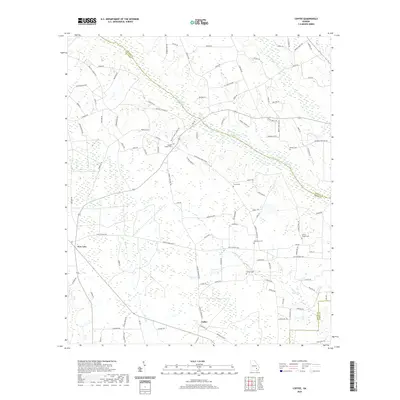
2020 Map of Coffee
USGS Topo · Published 2020About this map
Low-lying woodlands and swampy creek bottoms define this portion of Bacon County, Georgia, where the winding Big Satilla Cr serves as a natural boundary between Appling and Bacon counties. The landscape is characterized by a network of drainage systems including Fishfish Cr, Fishing Cr, and Briar Cr, which feed into the larger river basin. Settlement is centered around the small community of Coffee and the nearby New Lacy, connected by a rural road system that includes the Scuffletown Hwy.
Find a feature on this map
111 named features on this map. Tap any name to fly to it.
Don’t see what you’re looking for? This feature index may not catch every label — zoom into the map to look around manually.
Map Details
Editions of this 2020 Coffee Map
This is the sole edition of this map. No revisions or reprints were ever made.
Other maps of this area

1953 · Waycross
USGS Topo · 1:250,000

1958 · Waycross
USGS Topo · 1:250,000

1971 · Surrency
USGS Topo · 1:24,000

1971 · Coffee
USGS Topo · 1:24,000

1971 · K'ville
USGS Topo · 1:24,000

1971 · Alma NW
USGS Topo · 1:24,000

1971 · Patterson
USGS Topo · 1:24,000

1971 · Alma
USGS Topo · 1:24,000

1971 · Mershon
USGS Topo · 1:24,000
1971 · Alma NE
USGS Topo · 1:24,000