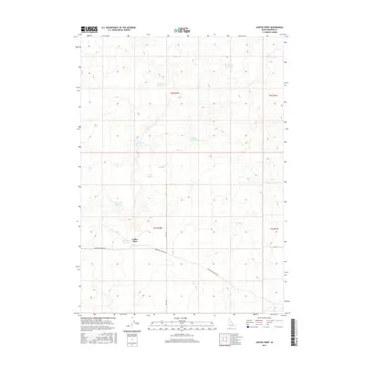
2017 Map of Coffee Point
USGS Topo · Published 2017About this map
Coffee Point and its associated Coffee Point Reservoir anchor this high-desert landscape in Bingham County. The terrain is defined by a sparse but vital network of water catchment features, including named reservoirs like Eagle Reservoir, Ripples Reservoir, and the descriptively named Sauce Pan Reservoir and Dry Wash Reservoir. These scattered catchments, along with Lau Lakes, suggest a landscape managed for seasonal grazing or local water storage in an otherwise arid environment. The human footprint is marked primarily by rural transit corridors, most notably Springfield Mosby Rd, which cuts across the lower half of the quadrangle. This 2017 survey captures the area's transition between township boundaries such as t2s r30e and t3s r30e, documenting the continued importance of water infrastructure in rural Idaho.
Find a feature on this map
16 named features on this map. Tap any name to fly to it.
Don’t see what you’re looking for? This feature index may not catch every label — zoom into the map to look around manually.
Map Details
Editions of this 2017 Coffee Point Map
This is the sole edition of this map. No revisions or reprints were ever made.
Other maps of this area

1955 · Idaho Falls
USGS Topo · 1:250,000

1958 · Idaho Falls
USGS Topo · 1:250,000

1972 · Split Top
USGS Topo · 1:24,000

1972 · Mosby Well
USGS Topo · 1:24,000

1972 · Sunset Lake
USGS Topo · 1:24,000

1973 · Rock Butte
USGS Topo · 1:24,000
1973 · Coffee Point SW
USGS Topo · 1:24,000

1973 · Lava Lake Reservoir
USGS Topo · 1:24,000

1973 · Coffee Point NE
USGS Topo · 1:24,000
1973 · Coffee Point
USGS Topo · 1:24,000