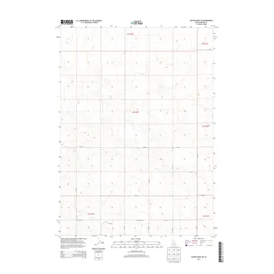
2013 Map of Coffee Point SW
USGS Topo · Published 2013About this map
Bingham County land patterns are defined by a strict geometric grid of survey lines and secondary roads in this 2013 topographic study. The terrain is characterized by subtle undulations, where the Public Land Survey System (PLSS) townships like t4s r30e and t5s r30e dictate the movement of local transit. Navigability in this portion of the Idaho landscape relies on a network of numbered rural routes, including W 1000 S and the long north-south axis of S 3500 W. Toward the southern edge of the quadrangle, Crater Sub Rd and S 3400 W intersect near the border of t5s r31e, reflecting the agricultural and ranching layout typical of the region. The absence of major named water bodies or urban centers emphasizes the open, rural character of this high-desert environment during the early twenty-first century.
Find a feature on this map
20 named features on this map. Tap any name to fly to it.
Don’t see what you’re looking for? This feature index may not catch every label — zoom into the map to look around manually.
Map Details
Editions of this 2013 Coffee Point SW Map
This is the sole edition of this map. No revisions or reprints were ever made.
Other maps of this area

1934 · American Falls
USGS Topo · 1:62,500

1936 · American Falls
USGS Topo · 1:62,500

1954 · Pocatello
USGS Topo · 1:250,000

1955 · Idaho Falls
USGS Topo · 1:250,000

1958 · Idaho Falls
USGS Topo · 1:250,000

1958 · Pocatello
USGS Topo · 1:250,000
1971 · Aberdeen
USGS Topo · 1:24,000

1971 · American Falls NW
USGS Topo · 1:24,000

1972 · Split Top
USGS Topo · 1:24,000

1972 · Mosby Well
USGS Topo · 1:24,000