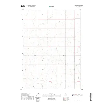
2020 Map of Coffee Point SW
USGS Topo · Published 2020About this map
The high desert landscape of t3s r30e and surrounding sections in Bingham County defines this modern topographic study. Primarily composed of open terrain and rolling contours, the area is partitioned by a strictly maintained grid of rural access routes. The transportation network is anchored by north-south arteries like 3300 West Rd and 3100 West Rd, which facilitate movement through the agricultural and range lands of t4s r30e and t5s r30e.
Find a feature on this map
18 named features on this map. Tap any name to fly to it.
Don’t see what you’re looking for? This feature index may not catch every label — zoom into the map to look around manually.
Map Details
Editions of this 2020 Coffee Point SW Map
This is the sole edition of this map. No revisions or reprints were ever made.
Other maps of this area

1934 · American Falls
USGS Topo · 1:62,500

1936 · American Falls
USGS Topo · 1:62,500

1954 · Pocatello
USGS Topo · 1:250,000

1955 · Idaho Falls
USGS Topo · 1:250,000

1958 · Idaho Falls
USGS Topo · 1:250,000

1958 · Pocatello
USGS Topo · 1:250,000
1971 · Aberdeen
USGS Topo · 1:24,000

1971 · American Falls NW
USGS Topo · 1:24,000

1972 · Split Top
USGS Topo · 1:24,000

1972 · Mosby Well
USGS Topo · 1:24,000