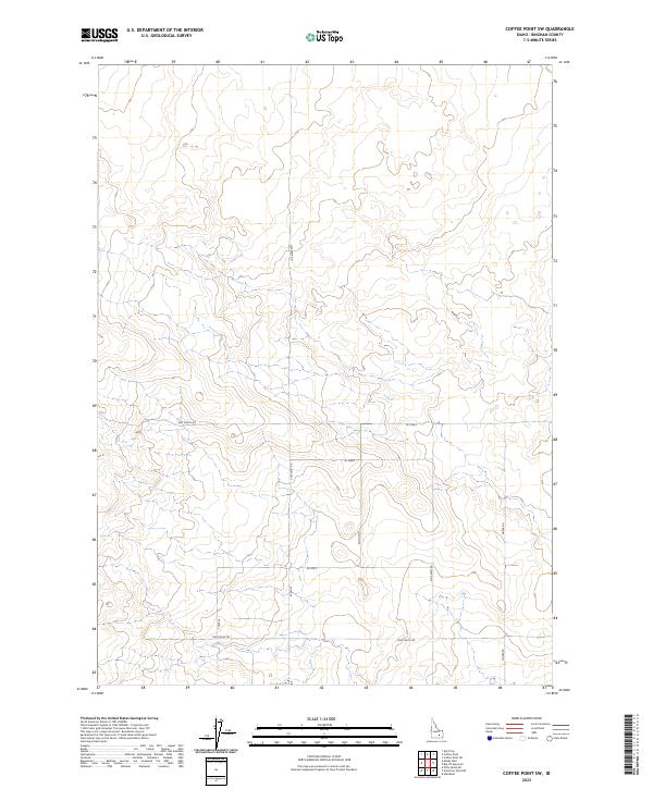
2023 Map of Coffee Point SW
USGS Topo · Published 2023About this map
Section lines and a rectangular grid of local roads define this portion of Bingham County, where the high desert terrain is surveyed into precise townships including t4s r30e and t5s r30e. The landscape is etched with the logic of the Public Land Survey System, with travel corridors like Duffin Rd and Moser Rd following the cardinal directions through the undulating contours. These routes, including 3300 West Rd and 1300 South Rd, provide the primary access through a region characterized by its lack of dense settlements, reflecting a pattern of expansive land use. The presence of numbered routes such as W 1200 S and S 3400 W suggests a modern rural addressing system imposed upon an area where the terrain's natural relief often dictates the subtle bends in the secondary paths.
Find a feature on this map
17 named features on this map. Tap any name to fly to it.
Don’t see what you’re looking for? This feature index may not catch every label — zoom into the map to look around manually.
Map Details
Editions of this 2023 Coffee Point SW Map
This is the sole edition of this map. No revisions or reprints were ever made.
Other maps of this area

1934 · American Falls
USGS Topo · 1:62,500

1936 · American Falls
USGS Topo · 1:62,500

1954 · Pocatello
USGS Topo · 1:250,000

1955 · Idaho Falls
USGS Topo · 1:250,000

1958 · Idaho Falls
USGS Topo · 1:250,000

1958 · Pocatello
USGS Topo · 1:250,000
1971 · Aberdeen
USGS Topo · 1:24,000

1971 · American Falls NW
USGS Topo · 1:24,000

1972 · Split Top
USGS Topo · 1:24,000

1972 · Mosby Well
USGS Topo · 1:24,000