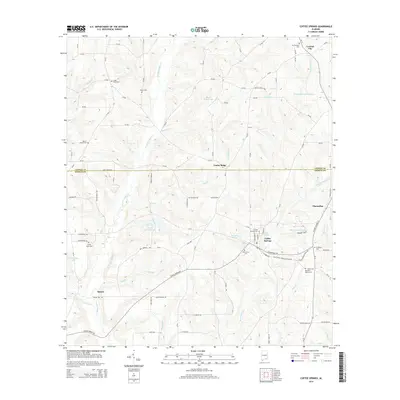
2014 Map of Coffee Springs
USGS Topo · Published 2014About this map
Coffee Springs serves as the focal point of this rural Alabama landscape, situated near the intersection of Al-27 and local routes in northern Geneva County. The town is surrounded by a network of family-named ponds and small water bodies, including Edwin Averett Lake, Lake Hulon, and Renzol Nichols Lake. The terrain is defined by its numerous small drainages such as Double Bridges Cr and Beaverdam Cr, which carve through the countryside to support a long history of local agriculture and homesteading.
Find a feature on this map
109 named features on this map. Tap any name to fly to it.
Don’t see what you’re looking for? This feature index may not catch every label — zoom into the map to look around manually.
Map Details
Editions of this 2014 Coffee Springs Map
This is the sole edition of this map. No revisions or reprints were ever made.
Other maps of this area

1942 · Enterprise
USGS Topo · 1:125,000

1950 · Enterprise
USGS Topo · 1:62,500

1953 · Andalusia
USGS Topo · 1:250,000

1953 · Dothan
USGS Topo · 1:250,000

1954 · Dothan
USGS Topo · 1:250,000

1955 · Dothan
USGS Topo · 1:250,000

1957 · Andalusia
USGS Topo · 1:250,000

1957 · Geneva
USGS Topo · 1:62,500

1957 · Bellwood
USGS Topo · 1:24,000
1957 · Geneva West
USGS Topo · 1:24,000