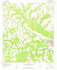
1957 Map of Geneva West
USGS Topo · Published 1959About this map
The confluence of the Pea River and numerous tributaries like Double Bridges Creek and Laddon Creek dominates this mid-century landscape in Geneva County. The city of Geneva sits at the southeastern corner, featuring a street grid that includes Cherokee St, Chocktaw St, and Ferris St near the local High Sch. Outside the town center, rural life is marked by a high density of country churches and family-named sites, such as Laddon Ch, Pleasant Ridge Ch, and McDuffie Cem.
Find a feature on this map
57 named features on this map. Tap any name to fly to it.
Don’t see what you’re looking for? This feature index may not catch every label — zoom into the map to look around manually.
Map Details
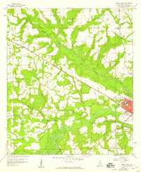
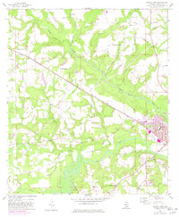
Editions of this 1957 Geneva West Map
3 editions found
Other maps of this area

1942 · Enterprise
USGS Topo · 1:125,000

1949 · Glendale
USGS Topo · 1:62,500

1949 · Hobbs Crossroads
USGS Topo · 1:24,000

1950 · Hobbs Cross Roads
USGS Topo · 1:24,000

1950 · Izagora
USGS Topo · 1:24,000

1951 · Glendale
USGS Topo · 1:62,500

1953 · Andalusia
USGS Topo · 1:250,000

1953 · Dothan
USGS Topo · 1:250,000

1954 · Dothan
USGS Topo · 1:250,000

1954 · Tallahassee
USGS Topo · 1:250,000