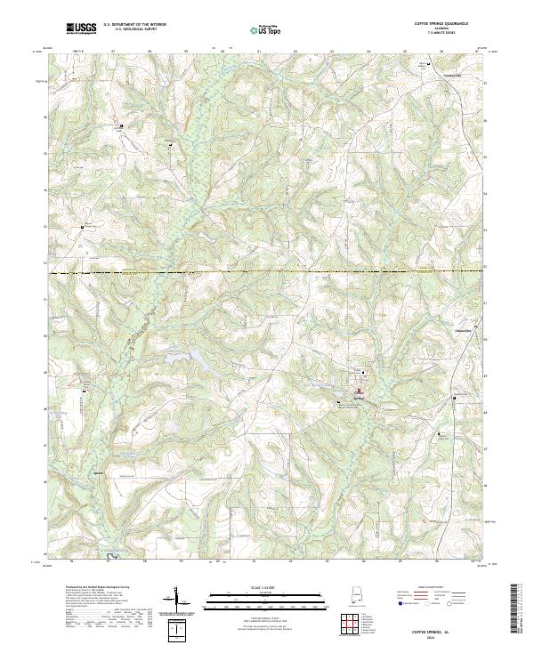
2024 Map of Coffee Springs
USGS Topo · Published 2024About this map
Coffee Springs sits at the heart of this Wiregrass region survey, where the landscape is defined by the intersection of the Coffee and Geneva county line. The settlement pattern reflects a deeply rooted rural community, anchored by numerous historic burying grounds and congregations such as Mount Carmel Primitive Baptist Church Cem, Marvin Chapel Cem, and Shady Grove Cem. These sites, often situated near minor crossroads, provide essential landmarks for genealogical research in southeastern Alabama.
Find a feature on this map
87 named features on this map. Tap any name to fly to it.
Don’t see what you’re looking for? This feature index may not catch every label — zoom into the map to look around manually.
Map Details
Editions of this 2024 Coffee Springs Map
This is the sole edition of this map. No revisions or reprints were ever made.
Other maps of this area

1942 · Enterprise
USGS Topo · 1:125,000

1950 · Enterprise
USGS Topo · 1:62,500

1953 · Andalusia
USGS Topo · 1:250,000

1953 · Dothan
USGS Topo · 1:250,000

1954 · Dothan
USGS Topo · 1:250,000

1955 · Dothan
USGS Topo · 1:250,000

1957 · Andalusia
USGS Topo · 1:250,000

1957 · Geneva
USGS Topo · 1:62,500

1957 · Bellwood
USGS Topo · 1:24,000
1957 · Geneva West
USGS Topo · 1:24,000