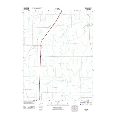
2011 Map of Coffey
USGS Topo · Published 2011About this map
Pattonsburg and the town of Coffey anchor this northern Missouri landscape at a time when modern highway corridors intersect with ancient drainage patterns. The Grand River flows through the southern portion of the quadrangle, collecting a network of local tributaries including Big Creek, Hog Creek, and Hickory Creek. This drainage system defines the local geography, with the small settlement of Cypress situated centrally among these winding waterways. The map illustrates a rural area defined by its sectional road grid, featuring many family-named routes and functional thoroughfares such as Elmwood Ave and Granite Ave. For genealogists and local historians, the Waters Cemetery and the location of Mooney Bridge over Big Creek provide specific points of interest for tracing land use and community connections in Daviess County. The juxtaposition of the Interstate 35 corridor against the quiet reaches of Little Cypress Creek highlights the evolution of travel in this agricultural region.
Find a feature on this map
27 named features on this map. Tap any name to fly to it.
Don’t see what you’re looking for? This feature index may not catch every label — zoom into the map to look around manually.
Map Details
Editions of this 2011 Coffey Map
This is the sole edition of this map. No revisions or reprints were ever made.
Other maps of this area

1922 · Gallatin
USGS Topo · 1:62,500

1924 · Winston
USGS Topo · 1:62,500

1925 · Pattonsburg
USGS Topo · 1:62,500

1925 · Gilman
USGS Topo · 1:62,500

1944 · Pattonsburg
USGS Topo · 1:62,500

1946 · Gilman
USGS Topo · 1:48,000

1946 · Pattonsburg
USGS Topo · 1:48,000

1948 · Gilman
USGS Topo · 1:62,500

1948 · Pattonsburg
USGS Topo · 1:62,500

1950 · Kansas City
USGS Topo · 1:250,000