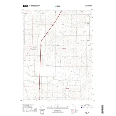
2017 Map of Coffey
USGS Topo · Published 2017About this map
Pattonsburg and Coffey anchor this corner of Daviess County, where the agricultural landscape is deeply defined by the winding course of the Grand River. In the northern reach, Big Creek and Little Cypress Cr feed into a network of drainages that cross a grid of rural routes like State Rd B and Elmwood Ave. This survey illustrates the modern transition of the area, notably where Interstate 35 bisects the terrain, bypassing the older town centers. Local history is preserved in landmarks such as Waters Cem and the Mooney Bridge crossing. The southern half of the map shows a complex watershed including Hickory Cr and Brushy Cr, highlighting the importance of river bottomlands to the local topography and land use patterns of northwestern Missouri.
Find a feature on this map
39 named features on this map. Tap any name to fly to it.
Don’t see what you’re looking for? This feature index may not catch every label — zoom into the map to look around manually.
Map Details
Editions of this 2017 Coffey Map
This is the sole edition of this map. No revisions or reprints were ever made.
Other maps of this area

1922 · Gallatin
USGS Topo · 1:62,500

1924 · Winston
USGS Topo · 1:62,500

1925 · Pattonsburg
USGS Topo · 1:62,500

1925 · Gilman
USGS Topo · 1:62,500

1944 · Pattonsburg
USGS Topo · 1:62,500

1946 · Gilman
USGS Topo · 1:48,000

1946 · Pattonsburg
USGS Topo · 1:48,000

1948 · Gilman
USGS Topo · 1:62,500

1948 · Pattonsburg
USGS Topo · 1:62,500

1950 · Kansas City
USGS Topo · 1:250,000