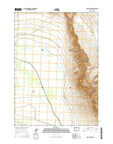
2014 Map of Coglan Buttes
USGS Topo · Published 2014About this map
Upper Chewaucan Marsh dominates the western half of this Lake County landscape, where a complex network of man-made irrigation and drainage features manage the flow of the Chewaucan River. The presence of the ZX Brattain Ditch, Red House Ditch, and Bagley Ditch highlights the region's historical reliance on water engineering for agricultural use. In contrast to the flat marshland, the eastern terrain rises sharply into the volcanic forms of the Coglan Buttes. This transition from a river-fed basin to high desert heights is punctuated by landmarks such as Coglan Canyon and the Shores Waterhole. Local pathways like Red House Ln and Lovers Ln provide ground-level context to the rural land divisions and ranching infrastructure that have long characterized this part of the Oregon high country.
Find a feature on this map
22 named features on this map. Tap any name to fly to it.
Don’t see what you’re looking for? This feature index may not catch every label — zoom into the map to look around manually.
Map Details
Editions of this 2014 Coglan Buttes Map
This is the sole edition of this map. No revisions or reprints were ever made.
Other maps of this area

1955 · Klamath Falls
USGS Topo · 1:250,000

1958 · Klamath Falls
USGS Topo · 1:250,000

1966 · Coglan Buttes NE
USGS Topo · 1:24,000

1966 · Morgan Butte
USGS Topo · 1:24,000

1966 · Tucker Hill
USGS Topo · 1:24,000

1966 · Coglan Buttes SE
USGS Topo · 1:24,000

1966 · Coglan Buttes
USGS Topo · 1:24,000

1966 · Paisley
USGS Topo · 1:24,000

1974 · Lake Abert
USGS Topo · 1:100,000

1985 · Sharp Top
USGS Topo · 1:24,000