
1966 Map of Coglan Buttes NE
USGS Topo · Published 1967About this map
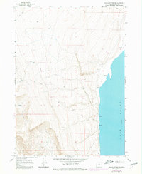
Lake Abert dominates the eastern portion of this high desert landscape, recorded here at an elevation of 4,255 feet. The shoreline is marked by several freshwater springs and a notable cave at the base of the rising escarpment. To the west, the terrain rises sharply into the high ridges, cut by the prominent Coglan Canyon. This 1966 field-checked survey captures the remote character of Lake County's interior, where transportation was limited to rugged paths like the Old Hotchkiss Road and various unnamed jeep trails. The sparse labels and lack of permanent settlements highlight the area's isolation, serving as a primary source for understanding the physical geography and the minimal human footprint on the edge of Oregon's Great Basin during the mid-1960s.
Find a feature on this map
13 named features on this map. Tap any name to fly to it.
Don’t see what you’re looking for? This feature index may not catch every label — zoom into the map to look around manually.
Map Details
Editions of this 1966 Coglan Buttes NE Map
2 editions found
Other maps of this area

1955 · Klamath Falls
USGS Topo · 1:250,000

1958 · Klamath Falls
USGS Topo · 1:250,000

1966 · Tucker Hill
USGS Topo · 1:24,000

1966 · Coglan Buttes SE
USGS Topo · 1:24,000

1966 · Coglan Buttes
USGS Topo · 1:24,000

1968 · Lake Abert North
USGS Topo · 1:24,000

1968 · Lake Abert South
USGS Topo · 1:24,000

1974 · Lake Abert
USGS Topo · 1:100,000
1984 · Sawed Horn
USGS Topo · 1:24,000

1985 · Sharp Top
USGS Topo · 1:24,000