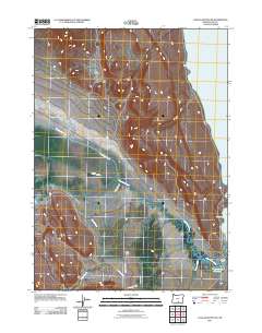
2011 Map of Coglan Buttes SE
USGS Topo · Published 2011About this map
Lake Abert dominates the eastern horizon of this high-desert landscape in Lake County, its shorelines providing a stark contrast to the agricultural infrastructure and ranching outposts to the west. The Chewaucan River winds through the central corridor, its flow managed by the Lower Marsh Canal and various irrigation channels that sustain local holdings like Elder Ranch and Johnson Ranch. This 2011 survey captures a quiet corner of Oregon where water management is central to survival. Tributaries such as Willow Creek, Crooked Creek, and Juniper Creek descend from the surrounding heights toward the Big Basin and the saline waters of the lake. Local transit is defined by rural routes including Clover Flat Rd and County Hwy 2-10, while the Coyote Flat Reservoir stands as a vital point of water storage in this arid environment.
Find a feature on this map
12 named features on this map. Tap any name to fly to it.
Don’t see what you’re looking for? This feature index may not catch every label — zoom into the map to look around manually.
Map Details
Editions of this 2011 Coglan Buttes SE Map
This is the sole edition of this map. No revisions or reprints were ever made.
Other maps of this area

1955 · Klamath Falls
USGS Topo · 1:250,000

1958 · Klamath Falls
USGS Topo · 1:250,000

1964 · Valley Falls
USGS Topo · 1:24,000

1964 · Clover Flat
USGS Topo · 1:24,000

1966 · Coglan Buttes NE
USGS Topo · 1:24,000

1966 · Tucker Hill
USGS Topo · 1:24,000

1966 · Coglan Buttes SE
USGS Topo · 1:24,000

1966 · Coglan Buttes
USGS Topo · 1:24,000

1968 · Lake Abert North
USGS Topo · 1:24,000

1968 · Lake Abert South
USGS Topo · 1:24,000