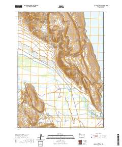
2020 Map of Coglan Buttes SE
USGS Topo · Published 2020About this map
The Chewaucan River winds through this high-desert basin, feeding into the extensive Lower Chewaucan Marsh before reaching the shores of Lake Abert. This landscape is defined by its water management and drainage patterns, illustrated by the Lower Marsh Canal, O V L Ditch, and Curtis Ditch. These human-made alterations to the natural hydrology support the surrounding territory near Big Basin and the higher elevations of the Coghlan Buttes range. To the southeast, the Coyote Flat Reservoir captures seasonal runoff from smaller tributaries like Crooked Cr and Juniper Cr. The primary thoroughfare through this sparsely settled region is Clover Flat Rd, which skirts the edge of the wetlands and provides access to the various creeks and drainages, including Willow Cr.
Find a feature on this map
16 named features on this map. Tap any name to fly to it.
Don’t see what you’re looking for? This feature index may not catch every label — zoom into the map to look around manually.
Map Details
Editions of this 2020 Coglan Buttes SE Map
This is the sole edition of this map. No revisions or reprints were ever made.
Other maps of this area

1955 · Klamath Falls
USGS Topo · 1:250,000

1958 · Klamath Falls
USGS Topo · 1:250,000

1964 · Valley Falls
USGS Topo · 1:24,000

1964 · Clover Flat
USGS Topo · 1:24,000

1966 · Coglan Buttes NE
USGS Topo · 1:24,000

1966 · Tucker Hill
USGS Topo · 1:24,000

1966 · Coglan Buttes SE
USGS Topo · 1:24,000

1966 · Coglan Buttes
USGS Topo · 1:24,000

1968 · Lake Abert North
USGS Topo · 1:24,000

1968 · Lake Abert South
USGS Topo · 1:24,000