
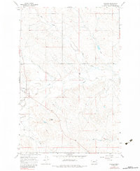
1965 Map of Cohagen
USGS Topo · Published 1968About this map
Cohagen sits at the western edge of this Garfield County landscape, serving as a focal point for the surrounding cattle country and dryland farming operations in the mid-1960s. The settlement pattern is defined by the network of seasonal watercourses and coulees, with White Horse Creek and Todd Coulee carving through the terrain near the Phillips Buttes. Local history is anchored at the Cohagen Cem, while the presence of a Landing Strip and numerous wells indicates the era's reliance on air travel and groundwater management in this expansive portion of Montana. The map also traces intricate drainage systems like Graveyard Creek and Little Dry Cr, which together illustrate the complex hydrography of the region before modern developments altered these traditional rural routes.
Find a feature on this map
17 named features on this map. Tap any name to fly to it.
Don’t see what you’re looking for? This feature index may not catch every label — zoom into the map to look around manually.
Map Details
Editions of this 1965 Cohagen Map
2 editions found
Other maps of this area

1954 · Jordan
USGS Topo · 1:250,000

1954 · Forsyth
USGS Topo · 1:250,000

1956 · Jordan
USGS Topo · 1:250,000

1957 · Forsyth
USGS Topo · 1:250,000

1958 · Jordan
USGS Topo · 1:250,000

1958 · Forsyth
USGS Topo · 1:250,000

1964 · Jordan
USGS Topo · 1:250,000

1965 · Black Hills
USGS Topo · 1:24,000

1965 · Calamity Coulee
USGS Topo · 1:24,000
1965 · York Reservoir
USGS Topo · 1:24,000