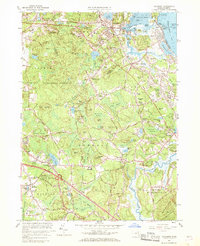
1961 Map of Cohasset
USGS Topo · Published 1969About this map
Cohasset Harbor and the jagged Atlantic shoreline anchor this coastal study, where the maritime traditions of the South Shore meet the expanding suburban footprint of the early 1960s. The landscape is defined by its numerous marshes and swamplands, such as Great Swamp and Black Pond Swamp, which dictated the winding paths of roads like Chief Justice Cushing Highway. While the northern reaches show established settlements like North Scituate and Egypt, much of the interior remains dominated by large wooded tracts and the significant US Government Reservation.
Find a feature on this map
169 named features on this map. Tap any name to fly to it.
Don’t see what you’re looking for? This feature index may not catch every label — zoom into the map to look around manually.
Map Details
Editions of this 1961 Cohasset Map
2 editions found
Other maps of this area

1885 · Abington
USGS Topo · 1:62,500

1885 · Duxbury
USGS Topo · 1:62,500

1888 · Duxbury
USGS Topo · 1:62,500

1888 · Abington
USGS Topo · 1:62,500

1892 · Boston Bay
USGS Topo · 1:62,500

1893 · Abington
USGS Topo · 1:62,500

1893 · Duxbury
USGS Topo · 1:62,500

1903 · Boston Bay
USGS Topo · 1:62,500

1918 · Duxbury
USGS Topo · 1:62,500

1920 · Abington
USGS Topo · 1:62,500