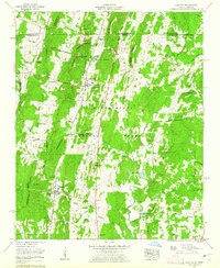
1960 Map of Cohutta
USGS Topo · Published 1962About this map
The Tennessee Valley Divide cuts through this landscape along the border of Georgia and Tennessee, shaping a region defined by agricultural valleys and the Chattahoochee National Forest. This 1960 era survey centers on the community of Cohutta, where the Southern railroad line runs past Pitner Hill. Nearby, the Cohutta National Fish Hatchery and numerous freshwater sources like Blue Spring and Sand Spring highlight the area's rich hydrology. To the south, the settlement of Varnell and the landmark Prater Mill on Coahulla Creek reflect the local economy of the mid-20th century. The map is a valuable resource for locating vanished landmarks and family sites, including several small country churches such as Concord Ch and Good Hope Ch, alongside cemeteries like Mt Olivet Cem and Goode Cem. The presence of the McGaughey Lookout Tower on a high ridge overlooking the forest indicates the ongoing importance of fire watch infrastructure at the time.
Find a feature on this map
53 named features on this map. Tap any name to fly to it.
Don’t see what you’re looking for? This feature index may not catch every label — zoom into the map to look around manually.
Map Details
Editions of this 1960 Cohutta Map
3 editions found
Other maps of this area

1886 · Dalton
USGS Topo · 1:125,000

1886 · Cleveland
USGS Topo · 1:125,000

1886 · Ringgold
USGS Topo · 1:125,000

1888 · Chattanooga
USGS Topo · 1:125,000

1892 · Ringgold
USGS Topo · 1:125,000

1892 · Cleveland
USGS Topo · 1:125,000

1892 · Dalton
USGS Topo · 1:125,000

1893 · Chattanooga
USGS Topo · 1:125,000

1895 · Cleveland
USGS Topo · 1:125,000

1897 · Dalton
USGS Topo · 1:125,000