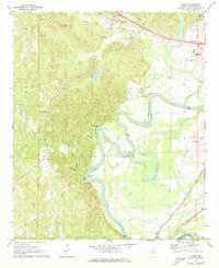
1969 Map of Coker
USGS Topo · Published 1973About this map
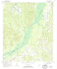
Coker and the surrounding Tuscaloosa County countryside are defined by the winding course of the Black Warrior River, which creates dramatic horseshoe loops at Snows Bend, Clement Bend, and Robinson Bend. The landscape is a mix of high bluffs like Carson Bluff and low-lying sloughs, such as Goose Pond Slough, reflecting the complex hydrology of the river valley. The Mobile and Ohio railroad corridor anchors the northern settlements, passing through the heart of Coker near Westwood Sch.
Find a feature on this map
49 named features on this map. Tap any name to fly to it.
Don’t see what you’re looking for? This feature index may not catch every label — zoom into the map to look around manually.
Map Details
Editions of this 1969 Coker Map
3 editions found
Other maps of this area

1924 · Tuscaloosa
USGS Topo · 1:62,500

1926 · Samantha
USGS Topo · 1:48,000

1926 · Tuscaloosa
USGS Topo · 1:62,500

1928 · Samantha
USGS Topo · 1:62,500

1953 · Birmingham
USGS Topo · 1:250,000

1956 · Birmingham
USGS Topo · 1:250,000

1957 · Birmingham
USGS Topo · 1:250,000

1967 · Elrod
USGS Topo · 1:24,000
1969 · Fosters
USGS Topo · 1:24,000
1970 · Romulus
USGS Topo · 1:24,000