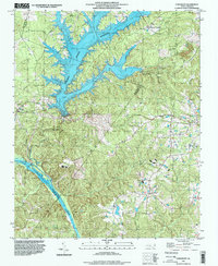
1993 Map of Cokesbury
USGS Topo · Published 1999About this map
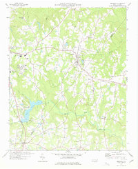
Shearon Harris Reservoir dominates the northern landscape of this region, its irregular shoreline reaching into the drainage of Norris Branch and Cary Branch. This area, where Wake, Chatham, Harnett, and Lee counties meet, shows a transition from the artificial water systems to the natural flow of the Cape Fear River in the south. The rural character of the late 20th century is punctuated by established communities like Hollemans Crossroads and Cokesbury. Local history is anchored by numerous spiritual landmarks including Collins Grove Ch, Prince Chapel, and Sweet Springs Ch. The topography rises to Chalk Level Hill in the south, while the Buckhorn Dam stands as a significant point of infrastructure along the river, marking the intersection of natural waterways and local utility development in this central North Carolina corridor.
Find a feature on this map
28 named features on this map. Tap any name to fly to it.
Don’t see what you’re looking for? This feature index may not catch every label — zoom into the map to look around manually.
Map Details
Editions of this 1993 Cokesbury Map
This is the sole edition of this map. No revisions or reprints were ever made.
Other maps of this area

1953 · Raleigh
USGS Topo · 1:250,000

1954 · Raleigh
USGS Topo · 1:250,000

1969 · New Hope Dam
USGS Topo · 1:24,000

1970 · Moncure
USGS Topo · 1:24,000

1974 · Apex
USGS Topo · 1:24,000
1974 · Fuquay-Varina
USGS Topo · 1:24,000
1974 · New Hill
USGS Topo · 1:24,000

1974 · Mamers
USGS Topo · 1:24,000
1974 · Cokesbury
USGS Topo · 1:24,000
1977 · Broadway
USGS Topo · 1:24,000