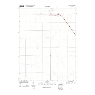
2009 Map of Colby SE
USGS Topo · Published 2009About this map
The North Fork Solomon River and South Fork Solomon River define the wide, drainage-cut plains southeast of Colby. This 2009 survey shows a landscape structured by a strict section-line road grid, including Co Rd 16, Co Rd 21, and Co Rd L. In the northern part of the map, residential and municipal expansion is visible through named streets like Zelfer Ave, Dylan Dr, and White Ave, contrasting with the open agricultural sections to the south. The convergence of Willow St and S Range indicates the edge of local development as the town footprint meets the Kansas prairie. These waterways and gravel roads provide a clear look at Thomas County's land use and hydrology at the end of the first decade of the 2000s.
Find a feature on this map
22 named features on this map. Tap any name to fly to it.
Don’t see what you’re looking for? This feature index may not catch every label — zoom into the map to look around manually.
Map Details
Editions of this 2009 Colby SE Map
This is the sole edition of this map. No revisions or reprints were ever made.
Other maps of this area

1943 · Colby
USGS Topo · 1:62,500

1954 · Goodland
USGS Topo · 1:250,000

1956 · Goodland
USGS Topo · 1:250,000

1957 · Goodland
USGS Topo · 1:250,000

1967 · Colby SE
USGS Topo · 1:24,000

1967 · Levant
USGS Topo · 1:24,000

1967 · Colby SW
USGS Topo · 1:24,000

1967 · Colby
USGS Topo · 1:24,000

1972 · Winona NE
USGS Topo · 1:24,000
1972 · Winona NW
USGS Topo · 1:24,000