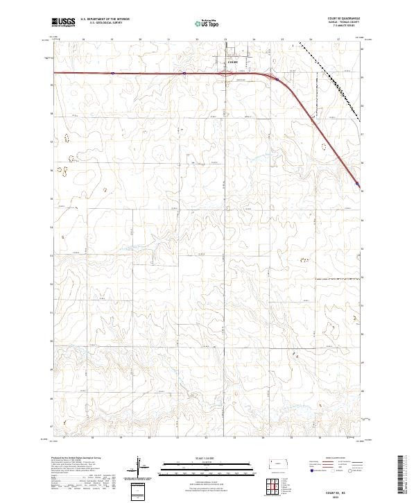
2022 Map of Colby SE
USGS Topo · Published 2022About this map
Colby occupies the northwestern corner of this Kansas survey, serving as a primary hub where Interstate 70 meets local thoroughfares like Davis Ave and Horton Ave. The landscape transitions from the developed streets of the city south into the agricultural plains of Thomas County. This area is defined by the headwaters of the Solomon River system, with the N Fork Solomon River and S Fork Solomon River cutting subtle drainage patterns through the high plains. The map reveals the rigid Public Land Survey System grid that organizes the region, delineated by numerous county roads such as Co RD Q and Co RD M that connect the isolated farmsteads across Townships 8 and 9 South. This layout illustrates the intersection of modern interstate transit with the traditional section-line road network that has governed the High Plains since settlement.
Find a feature on this map
19 named features on this map. Tap any name to fly to it.
Don’t see what you’re looking for? This feature index may not catch every label — zoom into the map to look around manually.
Map Details
Editions of this 2022 Colby SE Map
This is the sole edition of this map. No revisions or reprints were ever made.
Other maps of this area

1943 · Colby
USGS Topo · 1:62,500

1954 · Goodland
USGS Topo · 1:250,000

1956 · Goodland
USGS Topo · 1:250,000

1957 · Goodland
USGS Topo · 1:250,000

1967 · Colby SE
USGS Topo · 1:24,000

1967 · Levant
USGS Topo · 1:24,000

1967 · Colby SW
USGS Topo · 1:24,000

1967 · Colby
USGS Topo · 1:24,000

1972 · Winona NE
USGS Topo · 1:24,000
1972 · Winona NW
USGS Topo · 1:24,000