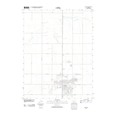
2009 Map of Colby
USGS Topo · Published 2009About this map
Colby serves as a primary hub for Thomas County, showing a well-defined street grid centered on the Thomas County Fairgrounds. The landscape is shaped by the drainage patterns of South Fork Sappa Creek to the north and Prairie Dog Creek to the south, highlighting the agricultural and transport-oriented layout of this High Plains settlement. Aviation plays a significant role in the local infrastructure, with both the Colby Municipal Airport and Murray Airport positioned near the town limits. Local history and genealogy are anchored by landmarks such as Beulah Cemetery and Sacred Heart Cemetery. The map illustrates a community structured around major thoroughfares like N Range Ave and Veterans Memorial Dr, reflecting the town's growth as a regional crossroads.
Find a feature on this map
51 named features on this map. Tap any name to fly to it.
Don’t see what you’re looking for? This feature index may not catch every label — zoom into the map to look around manually.
Map Details
Editions of this 2009 Colby Map
This is the sole edition of this map. No revisions or reprints were ever made.
Other maps of this area

1943 · Colby
USGS Topo · 1:62,500

1951 · Achilles
USGS Topo · 1:62,500

1951 · Chardon
USGS Topo · 1:62,500

1954 · Goodland
USGS Topo · 1:250,000

1956 · Goodland
USGS Topo · 1:250,000

1957 · Goodland
USGS Topo · 1:250,000

1967 · Colby SE
USGS Topo · 1:24,000

1967 · Levant
USGS Topo · 1:24,000

1967 · Colby SW
USGS Topo · 1:24,000

1967 · Colby
USGS Topo · 1:24,000