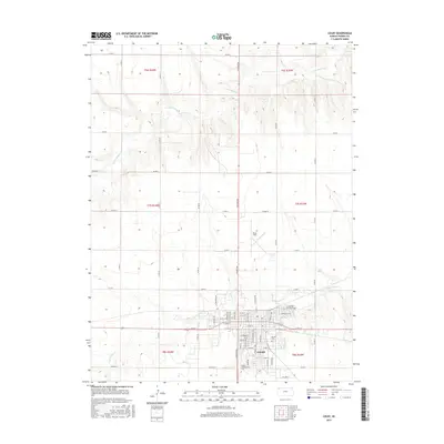
2015 Map of Colby
USGS Topo · Published 2015About this map
Colby serves as a significant High Plains hub in Thomas County, centered on a systematic grid of residential streets and educational facilities. The town's layout is defined by major thoroughfares such as N Range Ave and S Garfield Ave, which connect the commercial center to the campus of Colby Community Coll in the south. The surrounding landscape is dominated by agricultural sections and the hydrology of the High Plains, with the S Fork Sappa Cr cutting across the northern half of the quadrangle while Prairie Dog Cr meanders along the southern edge near the city limits. Local history is preserved at the Sacred Heart Cem and Beulah Cem, while the regional aviation presence is marked by Shatz Field to the north, illustrating the intersection of established prairie settlements and modern infrastructure.
Find a feature on this map
47 named features on this map. Tap any name to fly to it.
Don’t see what you’re looking for? This feature index may not catch every label — zoom into the map to look around manually.
Map Details
Editions of this 2015 Colby Map
This is the sole edition of this map. No revisions or reprints were ever made.
Other maps of this area

1943 · Colby
USGS Topo · 1:62,500

1951 · Achilles
USGS Topo · 1:62,500

1951 · Chardon
USGS Topo · 1:62,500

1954 · Goodland
USGS Topo · 1:250,000

1956 · Goodland
USGS Topo · 1:250,000

1957 · Goodland
USGS Topo · 1:250,000

1967 · Colby SE
USGS Topo · 1:24,000

1967 · Levant
USGS Topo · 1:24,000

1967 · Colby SW
USGS Topo · 1:24,000

1967 · Colby
USGS Topo · 1:24,000