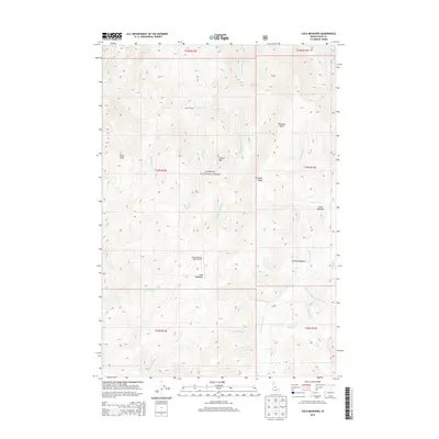
2013 Map of Cold Meadows
USGS Topo · Published 2013About this map
Cold Meadows USFS Airport stands as a focal point in this remote region of the Payette National Forest. The landscape is defined by its series of high-altitude clearings, including Cold Meadows, Middle Meadows, and Lower Meadow, which likely provided critical grazing or camping grounds for early forest travelers. The nomenclature across the terrain reflects the difficulties of the backcountry, with names such as Dismal Camp, Dismal Mtn, and Starvation Cr recorded alongside hopeful or cautionary labels like Runaway Ridge and Runaway Point. A dense network of headwaters, including Cottonwood Cr and Whimstick Cr, carve through the high elevations, illustrating the intricate drainage patterns that characterize the Idaho wilderness before these waters reach larger river systems.
Find a feature on this map
34 named features on this map. Tap any name to fly to it.
Don’t see what you’re looking for? This feature index may not catch every label — zoom into the map to look around manually.
Map Details
Editions of this 2013 Cold Meadows Map
This is the sole edition of this map. No revisions or reprints were ever made.
Other maps of this area

1956 · Elk City
USGS Topo · 1:250,000

1960 · Elk City
USGS Topo · 1:250,000

1962 · Vinegar Hill
USGS Topo · 1:24,000

1962 · Papoose Peak
USGS Topo · 1:24,000

1973 · Acorn Butte
USGS Topo · 1:24,000

1977 · Cottonwood Butte
USGS Topo · 1:24,000

1978 · Waugh Mountain
USGS Topo · 1:24,000

1978 · Arctic Point
USGS Topo · 1:24,000

1978 · Wapiti Creek
USGS Topo · 1:24,000

1978 · Devils Teeth Rapids
USGS Topo · 1:24,000