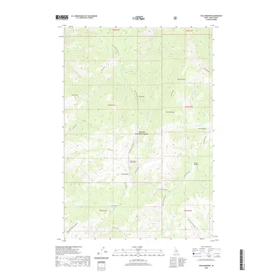
2020 Map of Cold Meadows
USGS Topo · Published 2020About this map
Payette National Forest dominates this high-altitude landscape in Idaho County, where the remote Cold Meadows clearing serves as a critical hub for mountain access. The presence of the Cold Meadows USFS Airport highlights the area's isolation, functioning as a primary entry point for forest management and fire crews. The terrain is defined by dramatic elevations such as Roots Knob, Dismal Mtn, and Cold Mountain, separated by a complex network of drainages including Dismal Cr and Disappointment Cr. These bleakly named watercourses reflect the difficulty of navigating this backcountry. To the east, the terrain transitions into a series of grassy openings like Lower Meadow and Middle Meadows, while long geographic features like Runaway Ridge and Frog Spring Ridge/Club Meadows provide natural corridors through the central wilderness area of Grass Mountain.
Find a feature on this map
38 named features on this map. Tap any name to fly to it.
Don’t see what you’re looking for? This feature index may not catch every label — zoom into the map to look around manually.
Map Details
Editions of this 2020 Cold Meadows Map
This is the sole edition of this map. No revisions or reprints were ever made.
Other maps of this area

1956 · Elk City
USGS Topo · 1:250,000

1960 · Elk City
USGS Topo · 1:250,000

1962 · Vinegar Hill
USGS Topo · 1:24,000

1962 · Papoose Peak
USGS Topo · 1:24,000

1973 · Acorn Butte
USGS Topo · 1:24,000

1977 · Cottonwood Butte
USGS Topo · 1:24,000

1978 · Waugh Mountain
USGS Topo · 1:24,000

1978 · Arctic Point
USGS Topo · 1:24,000

1978 · Wapiti Creek
USGS Topo · 1:24,000

1978 · Devils Teeth Rapids
USGS Topo · 1:24,000