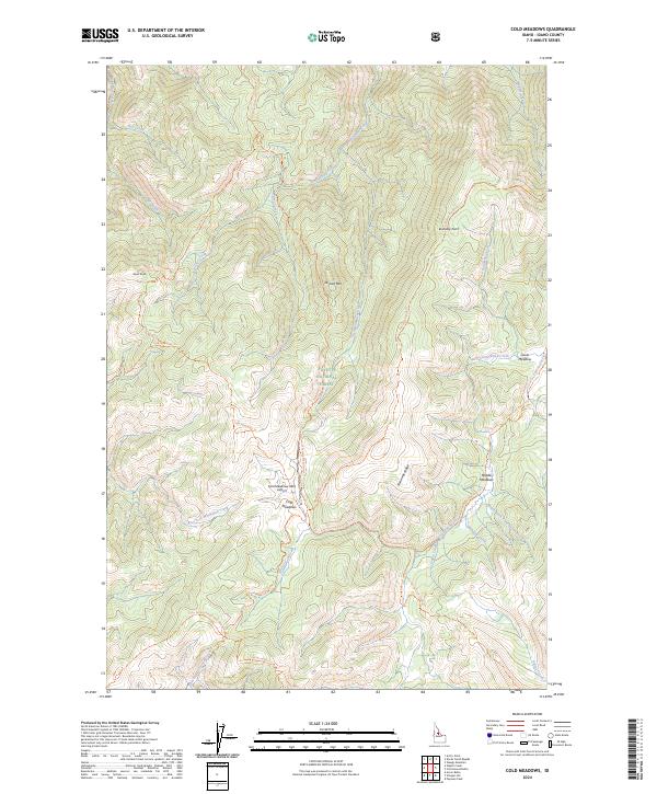
2024 Map of Cold Meadows
USGS Topo · Published 2024About this map
Cold Meadows serves as a remote hub within the high-elevation backcountry of the Frank Church-River of No Return Wilderness and Payette National Forest. This landscape is defined by its isolation and the network of primitive routes like the Cold Meadows Trl and Starvation Trl that navigate steep drainages and high points such as Roots Knob and Dismal Mtn. The topography is marked by curiously named watercourses, including Starvation Creek, Dismal Creek, and Disappointment Creek, reflecting the challenges of this wilderness terrain.
Find a feature on this map
39 named features on this map. Tap any name to fly to it.
Don’t see what you’re looking for? This feature index may not catch every label — zoom into the map to look around manually.
Map Details
Editions of this 2024 Cold Meadows Map
This is the sole edition of this map. No revisions or reprints were ever made.
Other maps of this area

1956 · Elk City
USGS Topo · 1:250,000

1960 · Elk City
USGS Topo · 1:250,000

1962 · Vinegar Hill
USGS Topo · 1:24,000

1962 · Papoose Peak
USGS Topo · 1:24,000

1973 · Acorn Butte
USGS Topo · 1:24,000

1977 · Cottonwood Butte
USGS Topo · 1:24,000

1978 · Waugh Mountain
USGS Topo · 1:24,000

1978 · Arctic Point
USGS Topo · 1:24,000

1978 · Wapiti Creek
USGS Topo · 1:24,000

1978 · Devils Teeth Rapids
USGS Topo · 1:24,000