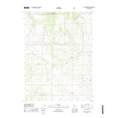
2018 Map of Cold Spring Mountain
USGS Topo · Published 2018About this map
The northern expanse of Modoc National Forest dominates this section of Lassen County, where the high-desert terrain transitions between forested uplands and open meadows. Local landmarks like Smith Flat and Blue Door Flat indicate the historic use of level terrain for ranching or seasonal camps within the larger volcanic landscape. The drainage network is complex, with Cedar Cr and Dry Cr cutting through the topography, while Moon Lake and the Big Meadows Reservoir provide critical water sources in an otherwise arid environment.
Find a feature on this map
23 named features on this map. Tap any name to fly to it.
Don’t see what you’re looking for? This feature index may not catch every label — zoom into the map to look around manually.
Map Details
Editions of this 2018 Cold Spring Mountain Map
This is the sole edition of this map. No revisions or reprints were ever made.
Other maps of this area

1886 · Alturas
USGS Topo · 1:250,000

1886 · Honey Lake
USGS Topo · 1:250,000

1891 · Honey Lake
USGS Topo · 1:250,000

1892 · Alturas
USGS Topo · 1:250,000

1893 · Honey Lake
USGS Topo · 1:250,000

1954 · Observation Peak
USGS Topo · 1:62,500

1954 · Ravendale
USGS Topo · 1:62,500

1954 · Alturas
USGS Topo · 1:250,000

1955 · Westwood
USGS Topo · 1:250,000

1958 · Alturas
USGS Topo · 1:250,000