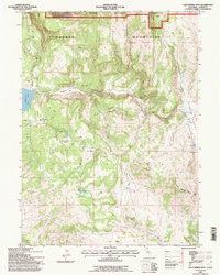
1993 Map of Cold Spring Mtn
USGS Topo · Published 1996About this map
The high ridges of the Warner Mountains dominate this landscape, showing a region of Modoc National Forest defined by remote ranching structures and alpine water sources in the early 1990s. Remote outposts such as Christensen Corral and Streshley Cabin indicate the area's history of seasonal livestock grazing and forestry management. The topography is deeply incised by drainages like Deep Canyon and Cedar Creek, while Moon Lake and the Big Meadows Reservoir serve as critical water management points in an otherwise arid high-elevation environment. The naming of features like Blue Door Flat and Dill Field suggests a layer of local heritage and personal history tied to specific clearings and cattle range. Clarks Valley provides a rare stretch of level ground on the eastern edge of the quadrangle, overshadowed by the prominent peak of Cold Spring Mtn.
Find a feature on this map
19 named features on this map. Tap any name to fly to it.
Don’t see what you’re looking for? This feature index may not catch every label — zoom into the map to look around manually.
Map Details
Editions of this 1993 Cold Spring Mtn Map
This is the sole edition of this map. No revisions or reprints were ever made.
Other maps of this area

1886 · Alturas
USGS Topo · 1:250,000

1886 · Honey Lake
USGS Topo · 1:250,000

1891 · Honey Lake
USGS Topo · 1:250,000

1892 · Alturas
USGS Topo · 1:250,000

1893 · Honey Lake
USGS Topo · 1:250,000

1954 · Observation Peak
USGS Topo · 1:62,500

1954 · Ravendale
USGS Topo · 1:62,500

1954 · Alturas
USGS Topo · 1:250,000

1955 · Westwood
USGS Topo · 1:250,000

1958 · Alturas
USGS Topo · 1:250,000