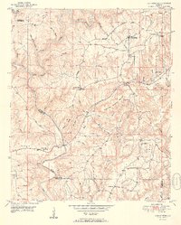
1951 Map of Cold Springs
USGS Topo · Published 1951About this map
Cold Springs serves as a focal point for this rural landscape in Cullman County, where the settlement pattern follows the high ridges between winding watercourses. The map documents a community deeply rooted in its local institutions, evidenced by a dense network of country churches such as Sandlin Chapel, McKinley Chapel, and Antioch Ch. Much of the northern terrain is defined by the Sipsey Fork and Ryan Creek, while the southern reaches are marked by the presence of Drummond Sch and the Banking Grounds. The infrastructure of the early 1950s is captured through features like the Parker Bridge and the Airway Beacon, reflecting the technological layer of the era atop older landmarks like Mail Route Mtn and Hammonds Shinbone Mountain. This survey provides an essential view of North Alabama before extensive modern development altered the character of these small crossroad communities.
Find a feature on this map
57 named features on this map. Tap any name to fly to it.
Don’t see what you’re looking for? This feature index may not catch every label — zoom into the map to look around manually.
Map Details
Editions of this 1951 Cold Springs Map
2 editions found

Other maps of this area

1888 · Cullman
USGS Topo · 1:125,000

1889 · Birmingham
USGS Topo · 1:125,000

1892 · Cullman
USGS Topo · 1:125,000

1892 · Birmingham
USGS Topo · 1:125,000

1893 · Jasper
USGS Topo · 1:125,000

1895 · Birmingham
USGS Topo · 1:125,000

1907 · Birmingham
USGS Topo · 1:125,000

1949 · Cordova
USGS Topo · 1:24,000

1949 · Sipsey
USGS Topo · 1:24,000

1949 · Cold Springs
USGS Topo · 1:24,000