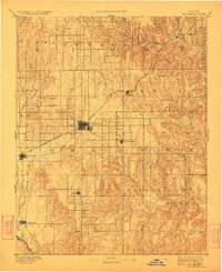
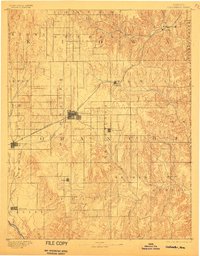
1892 Map of Coldwater
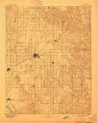
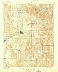
USGS Topo · Published 1924About this map
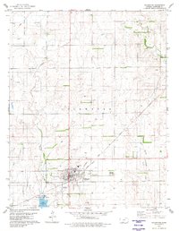
Coldwater serves as the central hub of this late-nineteenth-century survey of Comanche County, located at the intersection of a developing rail network and the surrounding prairie. The Atchison Topeka and Santa Fe R. R. cuts a diagonal path through the northern half of the region, connecting smaller settlements like Belvidere and Wilmore to the county seat. This rail access was essential for the movement of goods and livestock in an area defined by its hydrology and livestock potential. The landscape is deeply incised by drainage systems including Cavalry Creek and Bluff Creek, which flow south toward the Cimarron River at the map's southern edge. In addition to the larger towns, the map records established communities such as Nescatunga, Protection, and Avilla, many of which were centers for the early homesteading and ranching families of southwestern Kansas during this era of rapid settlement.
Find a feature on this map
27 named features on this map. Tap any name to fly to it.
Don’t see what you’re looking for? This feature index may not catch every label — zoom into the map to look around manually.
Map Details
Editions of this 1892 Coldwater Map
5 editions found

Historical Maps of Coldwater Through Time
7 maps found